Min Bid: $200 (0 bids)
The 30 Minute Rule begins April 17 at 7:00 PM EDT. An Initial Bid Must Be Placed By April 17 at 6:00 PM EDT To Participate After 6:00 PM EDT
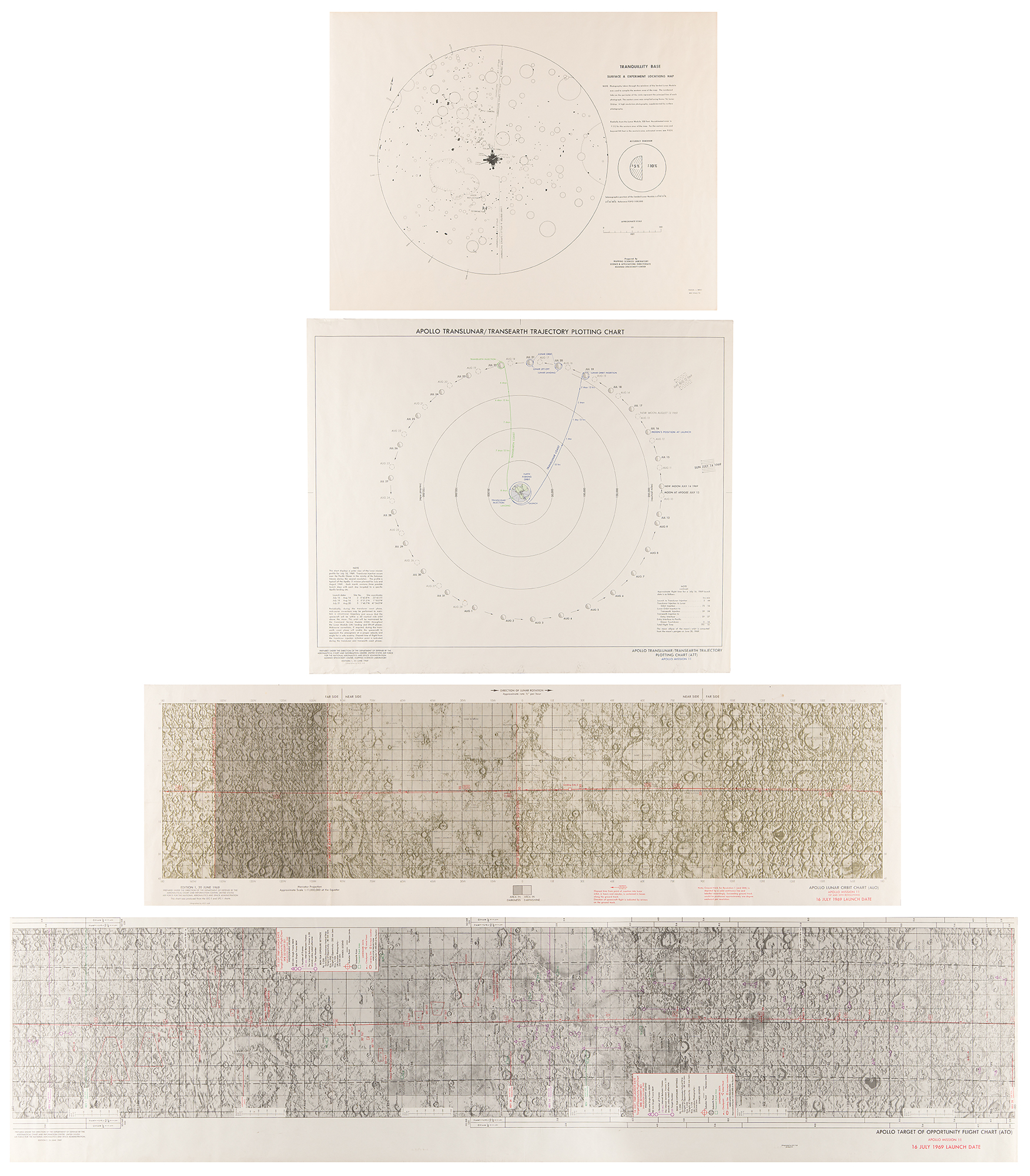
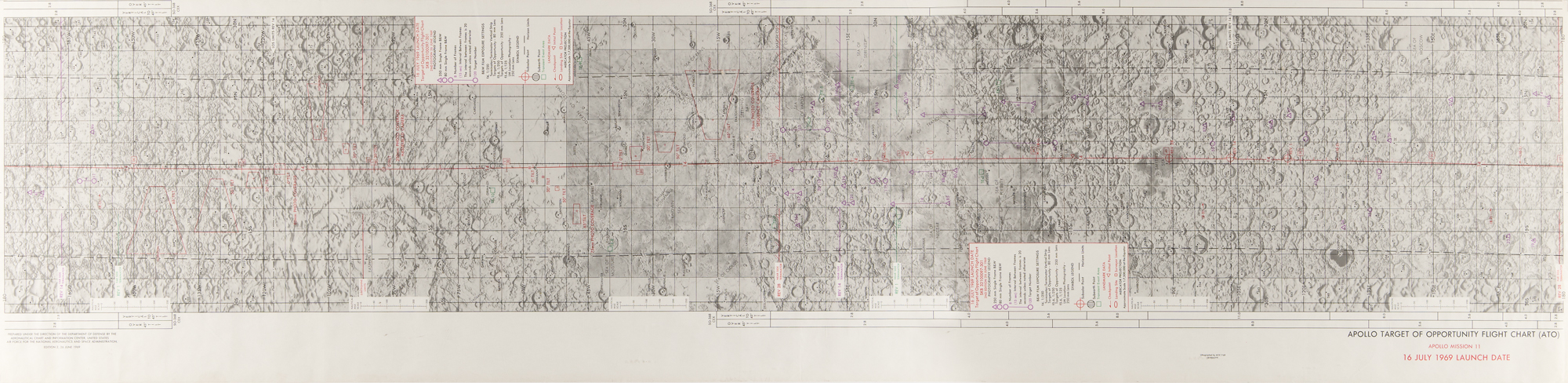
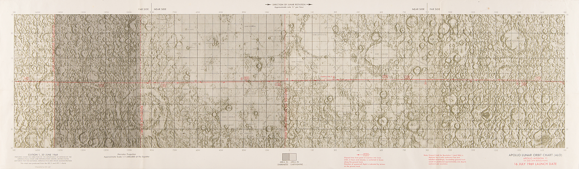
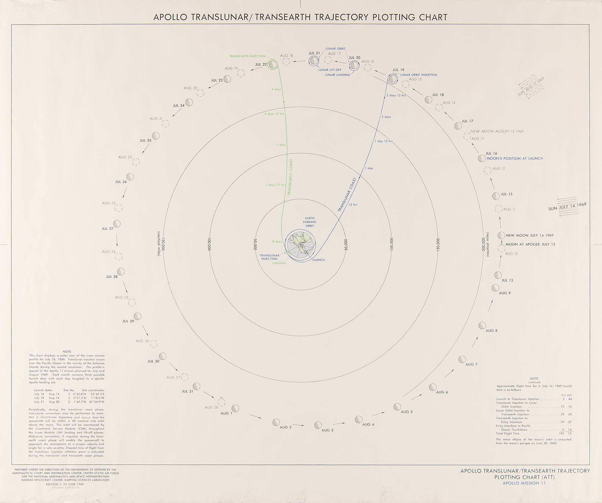
Attractive group of four NASA charts and maps for the Apollo 11 mission:
- Color first edition of the Apollo 11 Translunar/Transearth Trajectory Plotting Chart (ATT), 23.75 x 20, dated June 23, 1969. Prepared under the direction of the Department of Defense by the Aeronautical Chart and Information Center.
- Color first edition of the Apollo 11 Lunar Orbit Chart, 41 x 12, dated June 20, 1969. Lithographed by ACIC 6-69, and prepared under the direction of the Department of Defense by the Aeronautical Chart and Information Center.
- Color second edition of the Apollo 11 Target of Opportunity Flight Chart, 58.25 x 14, issued as SKB 32100097-301, dated June 26, 1969. Lithographed by ACIC 7-69, and prepared under the direction of the Department of Defense by the Aeronautical Chart and Information Center.
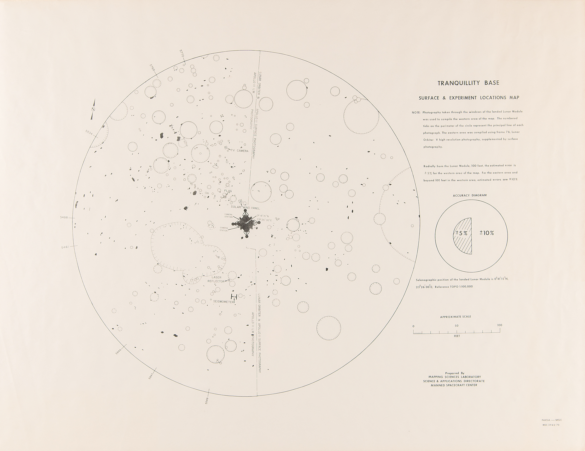
- Uncommon ‘Surface & Experiment Location Map’ for ‘Tranquility Base,’ the landing site of the Apollo 11 mission, 22 x 17, showing the placement of the Lunar Module Eagle, American flag, TV camera, solar wind panel, seismometer, and laser reflector. Prepared by the Mapping Sciences Laboratory, Science & Applications Directorate of the Manned Spacecraft Center.
All are rolled in overall fine condition, with vertical folds to the Lunar Orbit Chart, and wear to bottom edge of the ATT chart.

