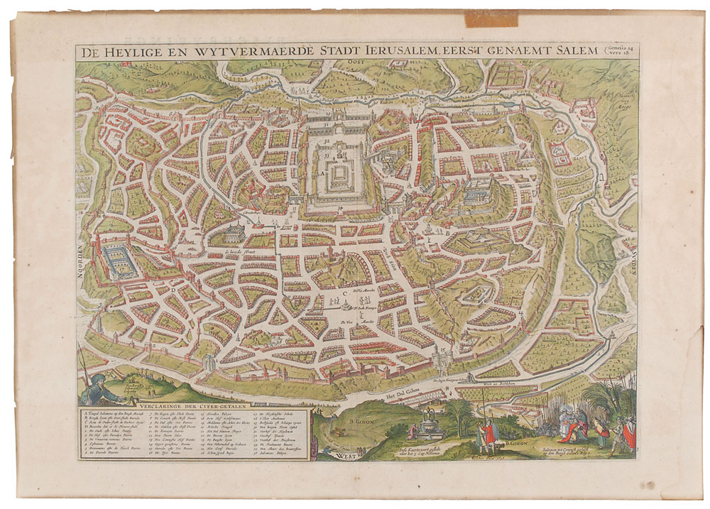
Striking hand-colored map of ancient Jerusalem by the eminent Visscher family cartographers of Amsterdam, 19.75 x 14, circa 1648, depicting the walled city and identifying dozens of sites and biblical stories, including Herod's Palace, Mount Zion, Moloch’s Temple, the gate of Ephraim, and Solomon's Palace. Text on the reverse is in Dutch and titled “Beschryvinge Van Ierusalem.” Light foxing and soiling, toning to edges, and a toned tape remnant and light dampstaining confined to borders, otherwise fine condition. Claes Jansz Visscher established his firm in Amsterdam and it is believed he may have been a pupil of Jadocus Hondius. Many maps bear the imprint Piscator [a Latinized version of Visscher] and often feature, as this one does, the image of an elderly fisherman.
We use cookies on this site to improve your experience. By using this site, you accept our use of cookies. To learn more, please see our Privacy Policy.